Open, no restrictions
Hospental - Airolo
Important notice: the Gotthard Pass will reopen today, 28 September 2025, at 11:00 a.m.
Tremola (Strada turistica) Passhöhe - Airolo: 3.5 t.
Updated on: 08.10.2025, 23:07
History
The Gotthard Pass divides the waters and connects different cultural and linguistic areas. Its importance as an "Alpine transversal" began at the beginning of the 13th century with the construction of the legendary Devil's Bridge in the Schöllenen Gorge. For many centuries, trade caravans (in exchange of cattle and cheese for grain, wine, rice and salt), rice runners, dispatch runners and even whole armies crossed the pass.
Between 1818 and 1836, the canton of Uri, with the help of other cantons, extended the pass road, which also gave it supremacy among the Swiss Alpine crossings. The Gotthard pass has had a decisive influence on the economy and culture in Central Switzerland for centuries. Until the opening of the Gotthard Railway in 1882, the Gotthard Pass was also used in winter. Dozens of path and shovel servants were employed for this purpose.
In 1922, the post bus replaced the stagecoach and with the introduction of gasoline duties in 1923, the expansion of the pass roads began until today. The old pass road on the south side, the Tremola between the top of the pass and Airolo is still preserved and passable. This stretch of road is reminiscent of more tranquil journeys over the Gotthard, not so long ago. In the 19th and 20th centuries, the Gotthard Pass was "condensed" into a myth, a symbol of Switzerland's independence, unity and identity.
Closed time during winter: Opening / Closing Gotthardpass
| Pass/Year | 2025 | 2024 | 2023 | 2022 | 2021 | 2020 | 2019 | 2018 | 2017 | 2016 | 2015 | 2014 | 2013 | 2012 | 2011 | 2010 | 2009 | 2008 | 2007 | 2006 | 2005 | 2004 | 2003 | 2002 | 2001 | 2000 | 1999 | 1998 | 1997 | 1996 | 1995 | 1994 | 1993 | 1992 |
|---|---|---|---|---|---|---|---|---|---|---|---|---|---|---|---|---|---|---|---|---|---|---|---|---|---|---|---|---|---|---|---|---|---|---|
| Gotthardpass | 29.05. - 14.11. | 17.05. - 09.11. | 20.05. - 10.11. | 21.05. - 05.11. | 20.05. - 28.10. | 30.05. - 04.11. | 25.05. - 29.10. | 21.05. - 06.11. | 20.05. - 08.11. | 13.05. - 19.11. | 23.05. - 03.11. | 30.05. - 07.11. | 23.05. - 05.11. | 30.04. - 01.12. | 20.05. - 04.11. | 27.05. - 06.11. | 21.05. - 31.10. | 04.05. - 08.11. | 19.05. - 15.11. | 13.05. - 21.11. | 28.05. - 29.10. | 17.05. - 03.11. | 17.05. - 07.11. | 01.06. - 21.12. | 26.05. - 02.11. | 28.05. - 22.10. | 20.05. - 25.10. | 16.05. - 10.11. | 24.05. - 08.11. | 31.05. - 02.11. | 20.05. - 05.11. | 19.05. - 15.11. | 27.05. - 26.10. |
Accommodation and activities
- Passo San Gottardo
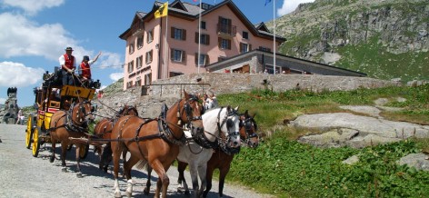 History made in the centre of Europe
 - Motel Gottardo Sud
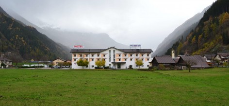 Well located on the North-South Highway
 - National Gotthard Museum
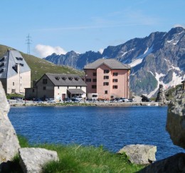 Culture on the Pass
 - Sasso San Gottardo
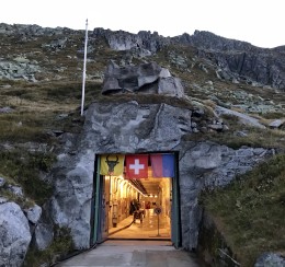 Discover the secrets of Fort Gotthard
 - Grand Tour of Switzerland
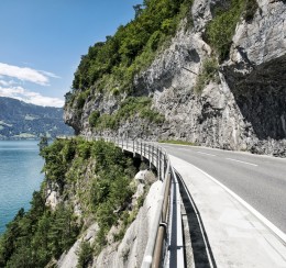 A journey of discovery through four different ling
 - Swiss Cycling Alpenbrevet
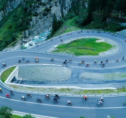 The Swiss Cycling Alpenbrevet excites the whole region
Technical Data
Location
Signalisation
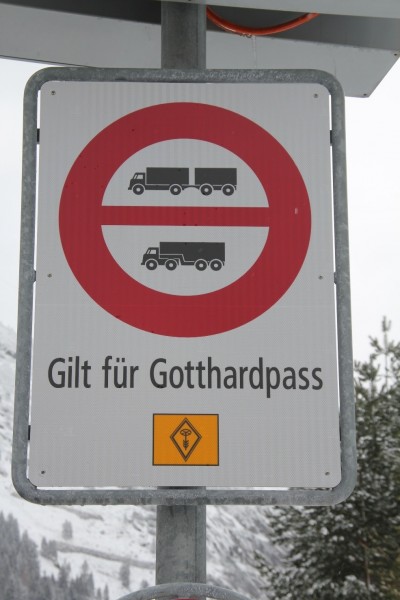
- Verbot für Lastenzüge und Sattelschlepper (Gilt ab Göschenen bzw. Airolo)
- Ausgenommen sind militärische Transporte
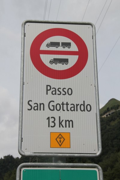
- Verbot für Lastenzüge und Sattelschlepper (Gilt ab Göschenen bzw. Airolo)
- Ausgenommen sind militärische Transporte
- Tremola (Strada turistica) Airolo – Passhöhe Höchstgewicht 3.5t
Passes
-
- 6°COpen, no restrictionsUpdated on: 06.10.2025, 06:54
Pontresina - San Carlo
Winter tyres are obligatory for the whole winter period. Depending on the weather conditions, snow chains may be obligatory over a short period, or the pass may close.
- 8°COpen, no restrictionsUpdated on: 23.08.2025, 08:31
Lungern - Brienzwiler
Winter tyres are obligatory for the whole winter period. Depending on the weather conditions, snow chains may be obligatory over a short period, or the pass may close completely.
- 9°COpen, no restrictionsUpdated on: 07.10.2025, 08:54
- 7°COpen, with restrictionsUpdated on: 13.10.2025, 10:13
Realp - Oberwald
From today, 13 October 2025, there will be a night-time closure between 6 p.m. and 8 a.m. from Realp to Gletsch.
- 7°COpen, no restrictionsUpdated on: 06.10.2025, 06:54
La Motta - Country border
Traffic information for the bordering South Tyrol/Passes: www.suedtirol.com/verkehr/berg-paesse
- 5°COpen, no restrictionsUpdated on: 23.05.2025, 18:05
Sarnen - Entlebuch
On the Obwalden side, the road remains open during the winter as far as Langis.
- 5°CClosed until further noticeUpdated on: 13.10.2025, 06:41
Giswil - Sörenberg, "Panoramastrasse"
Due to construction work between Mörlialp and the Glaubenbielen car park, this section of the route will be closed to all traffic from 6:45 a.m. on 13 October 2025. Weather permitting, access from Sörenberg to the Glaubenbielen car park and from the Obwalden side to Mörlialp will be permitted. Once the construction work has been completed, the usual winter closure is expected to take effect.
Important note: The Panoramastrasse on the Obwaldner side open during the winter to Mörlialp. Restrictions for coaches and trucks see section Signalization.
- 10°COpen, no restrictionsUpdated on: 08.10.2025, 23:07
Hospental - Airolo
Important notice: the Gotthard Pass will reopen today, 28 September 2025, at 11:00 a.m.
Tremola (Strada turistica) Passhöhe - Airolo: 3.5 t.
- 1°COpen, with restrictionsUpdated on: 17.10.2025, 10:58
Guttannen - Gletsch
From 20 October 2025, the Grimsel Pass will be closed at night between 6 p.m. and 8 a.m. On the Bernese side, it will remain open as far as Räterichsboden.
- 5°COpen, no restrictionsUpdated on: 09.10.2025, 18:36
Bourg-St-Pierre - national border
Important note: On 20 October 2025 from 0800 hours, the Great St Bernard Pass will be closed for the winter.
- 2°COpen, no restrictionsUpdated on: 18.05.2025, 14:09
Meiringen - Grindelwald
There is a general driving ban on motorized traffic between Schwarzwaldalp and Grindelwald (Hotel Wetterhorn).
-
- 10°COpen, no restrictionsUpdated on: 28.09.2025, 05:49
Bivio - Silvaplana
Winter equipment is mandatory during the winter months. Snow chains are compulsory for a limited period of time depending on the circumstances, as is any closure of the pass.
- 10°COpen, no restrictionsUpdated on: 08.10.2025, 11:51
Urigen - Urnerboden
Info for car travel summer 2025:
2.30 m wide, two-axle and 18-ton vehicles do not require a permit, also applies at weekends.
From the opening of the pass in 2025 until its closure in 2025, single-decker, 2.55 m wide, two-axle and max. 18-ton touring cars (trailer ban) may travel on the Klausen Pass from Monday to Friday with a special permit. Monday, Wednesday and Friday from Unterschächen to Linthal. Tuesday and Thursday from Linthal to Unterschächen. Timing must be coordinated with Postbus routes.
Permits can be obtained from the Road Traffic Office of the Canton of Uri or the Canton of Glarus.Permits for Linthal – Unterschächen can be obtained at:
Strassenverkehrs- u. Schifffahrtsamt des Kanton Glarus,
Mühleareal17
8762 Schwanden
Tel 055 646 54 00
E-Mail: stva@gl.ch
Permits for Unterschächen - Linthal can be obtained at:
Amt für Strassen- und Schiffsverkehr
Gotthardstrasse 77a
6460 Altdorf
Tel 041 875 28 06
E-Mail: sonderbewilligungen@ur.ch
https://www.ur.ch/publikationen/6500 - 11°COpen, no restrictionsUpdated on: 29.09.2025, 06:44
Fuorns - Campra
Winter tyres are obligater for the whole winter period. Depending on the weather conditions, snow chains may be obligatory over a short period, or the pass imay close completely. See also www.lucomagno.ch
- 12°COpen, no restrictionsUpdated on: 27.08.2025, 08:25
Silvaplana - Casaccia
Winter tyres are obligatory for the whole winter period. Depending on the weather conditions, snow chains may be obligatory over a short period, or the pass may close Complete,
- 6°COpen, no restrictionsUpdated on: 07.10.2025, 08:09
All' Acqua - Ulrich
On the Ticino side open during the winter to All'Acqua.
-
- 10°COpen, no restrictionsUpdated on: 10.10.2025, 09:28
Zernez - Tschierv
Important note: Due to construction work, the Munt La Schera tunnel between Punt la Drossa and Punt dal Gall (access to Livigno) will be closed to all traffic from 20 October to 1 November 2025, Monday to Saturday, between 8 p.m. and 6 a.m.
Winter tyres are obligatory for the whole winter period. Depending on the weather conditions, snow chains may be obligatory over a short period, or the pass may close completely.
Traffic information for the bordering South Tyrol/Passes: www.suedtirol.com/verkehr/berg-paesse
- 10°COpen, with restrictionsUpdated on: 13.10.2025, 14:05
Muotathal - Glarus
Important note: From October 21, 2025, 7:30 a.m. until approximately October 31, 2025, Klöntalerstrasse will be closed between Büttenen and Löntschtobel. The diversion via Saggberg is signposted. The road will be open on the weekend of October 18/19, 2025.
The following traffic restrictions apply to the entire Pragelpass road:
1. Motor vehicles and motorcycles are prohibited on Saturdays and Sundays, 5.5 km after the
pass summit (cantonal border SZ/GL to Richisau, approx. 2 km)
2. On public holidays that do not fall on a Saturday or Sunday, the Pragelpass is normally passable
(except winter closure)
3. Maximum weight 3.5 tons (SSV signal 2.16) except for agricultural, alpine and forestry
traffic, traffic for the construction, operation and maintenance of public and private works (incl.
electrical infrastructures), traffic for milk processing plants and military traffic;
4. Driving ban for trailers (SSV signal 2.09) except for agricultural, alpine and forestry
traffic, traffic for the construction, operation and maintenance of public and private works (incl.
electrical infrastructures), traffic for milk processing plants and military traffic;
5. Maximum weight of agricultural, alpine and forestry traffic, traffic for the construction, operation and maintenance
of public and private works (incl. electrical infrastructure) and traffic for
milk processing plants incl. trailers 32 tons (SSV signal 2.16);
6. Maximum weight of military traffic incl. trailers 12 tons.
For special permits relating to weight restrictions, please use the application form on the
online portal. https://www.bezirk-schwyz.ch/aktuelles/pragelpass/ - 4°COpen, no restrictionsUpdated on: 29.09.2025, 10:47
Hinterrhein - San Bernardino (Pass road, italien road).
- 12°COpen, no restrictionsUpdated on: 28.09.2025, 08:23
Brig - Gondo
Winter tyres are obligatory for the whole winter period. Depending on ithe weather conditions, snow chains may be obligatory over a short period, or the pass may close completely.
-
- 0°COpen, with restrictionsUpdated on: 17.10.2025, 11:01
Wassen - Innertkirchen
From 20 October 2025, the Sustenpass Pass will be closed at night between 6 p.m. and 8 a.m. On the Bernese side, it will remain open as far as Steingletscher.
- 1°COpen, no restrictionsUpdated on: 25.09.2025, 10:49
Sta. Maria i. M. - country border
Traffic information for neighbouring South Tirol pass: www.suedtirol.com/verkehr/berg-paesse
